Controversial Flood Diversion Wouldn't Help Fargo With This Year's Flood Forecast

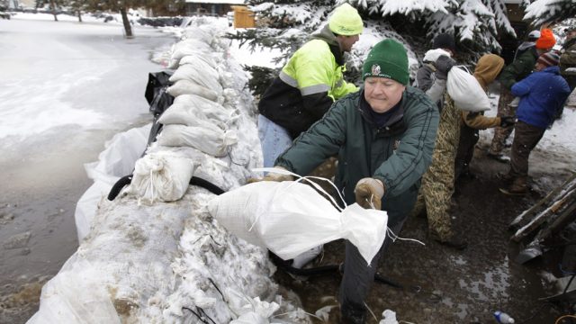
Folks in Fargo are worried about flooding this year, and for good reason. According to the Associated Press, the National Weather Service predicts the “most likely scenario” for the Red River peaking this spring “between 39 and 41 feet at Fargo and neighboring Moorhead, Minn., in late April or early May, with a maximum possibility of 42 feet.”
That would put the city at or above the 2009 record flood level for Fargo.
This has created an outcry for a controversial flood diversion project which has gotten much debate in the state legislature lately. The folks in Fargo want it because they think it will keep them from having to deal with flooding pretty much every spring. Some folks outside of Fargo don’t want the city’s flooding problems sent to their communities through diversion.
But here’s a question: Would the flood diversion, which is estimated to cost billions in local, state and federal tax dollars, really help with Fargo’s flooding? I think there’s no doubt it would help with smaller floods. But big floods such as the record-setting event in 2009, and possibly the flood forecast for this year? I’m not sure how much help the diversion would actually be.
And you don’t have to take my word for it. According to a draft scoping decision (and to be clear, this is a draft) posted on the Minnesota Department of Natural Resources website, a flood in the 35 to 40 foot range as measured in Fargo would still result in an emergency and evacuations (emphasis mine):
A stage of 35.0 feet would be maintained at the Fargo gage until the upstream staging elevation reaches 922.2 NAVD 88 (the staging elevation would just reach elevation 922.2 for the 1% (100-year event). Once the upstream staging elevation reaches 922.2, the Red River and Wild Rice River hydraulic control structure gates would be opened as necessary to maintain the upstream staging elevation of 922.2 while not exceeding a stage of 40.0 feet at the Fargo gage (a stage of 40.0 feet would occur for the expected 0.2% (500-yr) event).
Emergency measures would be employed within the risk reduction area to reduce flood damages when the stage is between 35.0 and 40.0 feet. If the upstream staging water surface elevation is forecasted to reach the point of minimum acceptable freeboard, an evacuation order would be issued for the metropolitan area. Once water is flowing over the overflow embankment and the upstream staging elevation reaches the point of minimum acceptable freeboard, the Red and Wild Rice River control structures would be opened further to maintain the minimum freeboard, and stages would rise above 40.0 feet at the Fargo gage.
What a lot of the proponents of Fargo flood diversion are assuming, I think, is that with diversion flooding events such as what happened in 2009 and what might happen this year would be a problem of the past. Except, that’s just not so. Even a 36-mile diversion costing billions of dollars, and causing untold headaches for citizens and property owners outside of Fargo, would not provide relief from these record-setting and near-record floods.
You could still argue that the diversion is worth it to protect against the smaller floods, I suppose, but the public perception of the diversion created by its supporters is that it’s a magic bullet to fix Fargo’s flood problems, and that’s just not true.


